Geography Of Belize
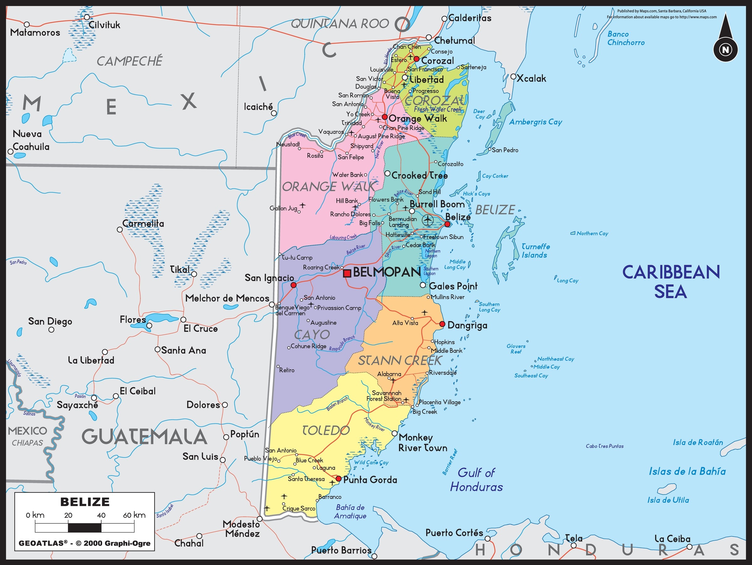
Belize is a crown jewel carefully carved out by the British over three centuries, located on the Caribbean coast of northern Central
America at 17°15′ north of the equator and 88°45′ west of the Prime Meridian on the Yucatán Peninsula. Central America is the narrow strip of land with sea on either side
that connects North America with South America. The country shares a land and sea border: on the north with Quintana Roo, Mexico,
on the west and south with Guatemala, and the Caribbean Sea on the East.
More than 50% of Belize is covered by tropical rain forest that's dissected by a network of rivers, mostly small in length. The area of the country totals 22,960 square kilometers (8,860 sq. mi), on the coast it has a swampy coastal plain that is dominated by mangrove swamps, while in the south and the interior there are hills and low mountains. Most of Belize is undeveloped and is forested with hardwoods. Belize is a part of the Mesoamerican biodiversity hotspot and has many jungles, wildlife reserves, a large variety of different species of flora and fauna, and the largest cave system in Central America. Some species of Belize include the black orchid, the mahogany tree, the toucan, and tapirs. The climate of Belize is tropical and is therefore very hot and humid. It has a rainy season that lasts from May to November and a dry season lasting from February to May.
More than 50% of Belize is covered by tropical rain forest that's dissected by a network of rivers, mostly small in length. The area of the country totals 22,960 square kilometers (8,860 sq. mi), on the coast it has a swampy coastal plain that is dominated by mangrove swamps, while in the south and the interior there are hills and low mountains. Most of Belize is undeveloped and is forested with hardwoods. Belize is a part of the Mesoamerican biodiversity hotspot and has many jungles, wildlife reserves, a large variety of different species of flora and fauna, and the largest cave system in Central America. Some species of Belize include the black orchid, the mahogany tree, the toucan, and tapirs. The climate of Belize is tropical and is therefore very hot and humid. It has a rainy season that lasts from May to November and a dry season lasting from February to May.